THIS WEATHER UPDATE IS 1 DAY OLD!
SEVERE THUNDERSTORMS POSSIBLE!!
📑 Severe Weather Details:
Below are the breakdowns of each of the hazards for each severe weather outlook. When we describe the hazards, it is for the parts inside and a little bit around Indiana.
📈 To see the latest Storm Prediction Center (SPC) graphics, radar, and more please go to the Pallsa Weather Dashboard and select a location to get all the weather data about that location.
🚨 We might have live updates later as the storms continue to develop and move through Indiana! You can view these live updates here (in this weather update), and at the top of a location's dashboard.
⛈️The chance of thunderstorms in Indiana will begin this afternoon, and go through tonight. Rain chances will go into Friday
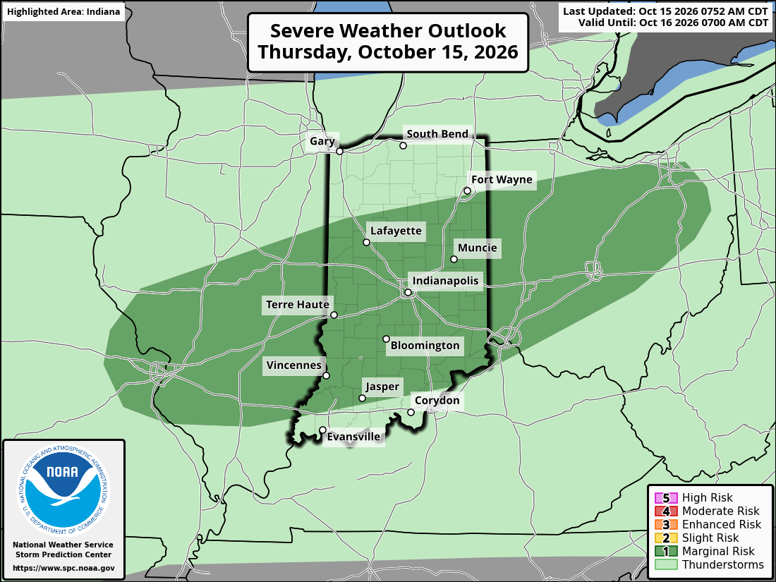
⛈️ Severe thunderstorms are possible Thursday:
🟩 For the area under a marginal risk (shaded dark green in day 1 to 3 SPC graphics), damaging wind gusts <70MPH and, in some areas, a couple tornadoes are possible.
⬜ For the area under a general thunderstorm risk (shaded light green in day 1 to 3 SPC graphics), non-severe thunderstorms are possible.
⛈️ Thunderstorms are again possible Friday:
⬜ For the area under a general thunderstorm risk (shaded light green in day 1 to 3 SPC graphics), non-severe thunderstorms are possible.
📢 🏃♀️➡️ Stay safe, and alert.
📃 Forecast information from: National Weather Service.
Severe Weather Information From: Storm Prediction Center.
2026-10-15